When it comes to contrail prediction, weather conditions play a crucial role. Contrails form in Ice-Super Saturated Regions (ISSRs), which depend on specific humidity and temperature. Recently, Deutscher Wetterdienst (DWD) made their ICON forecasts with the new 2-moment cloud microphysics scheme available. The primary use case is as numerical weather input for the monitoring solutions of the EU MRV. Recognizing this opportunity, Estuaire has integrated DWD forecasts into its climate impact engine, providing users with an additional high-resolution weather provider for more accurate contrail prediction.
Why DWD ICON - 2 Moment Weather Model Matters
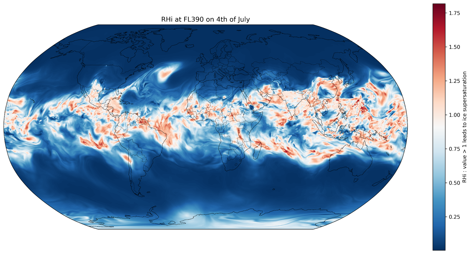
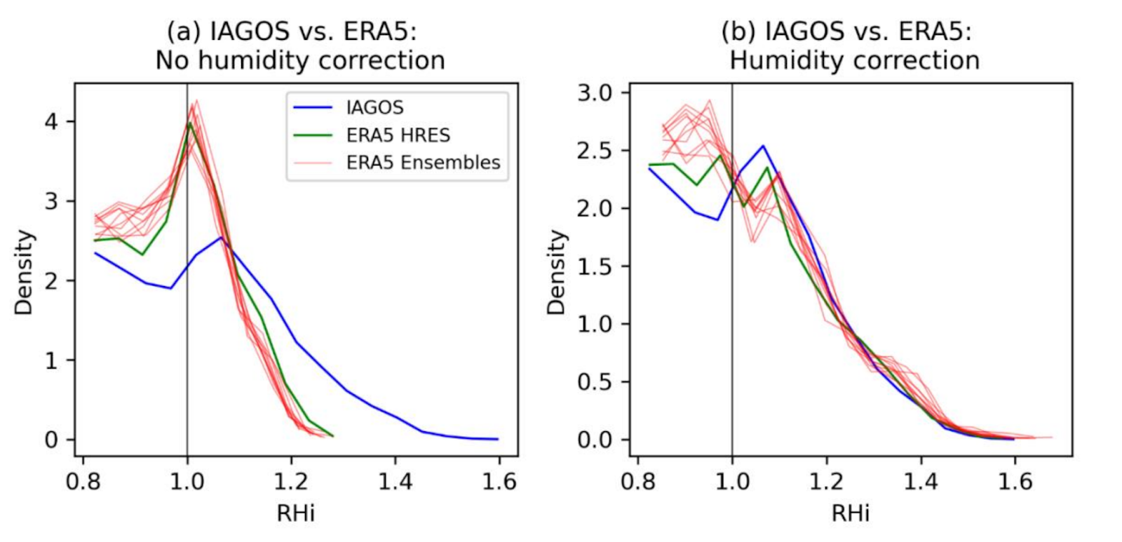
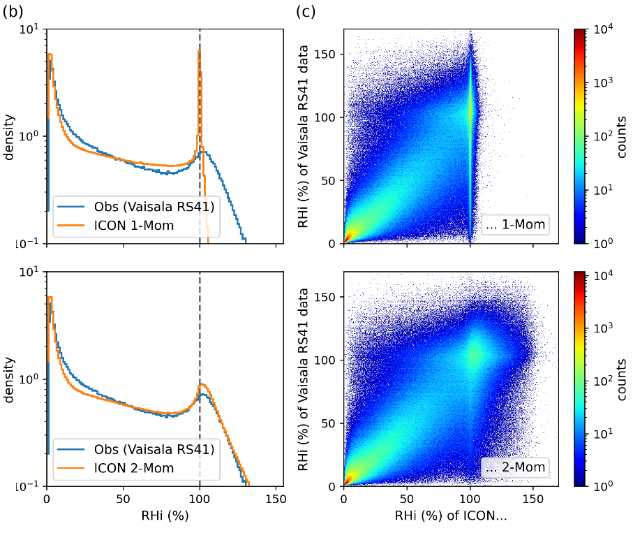
Until now, the primary industry standard has been ECMWF HRES (European Centre for Medium-Range Weather Forecasts High-Resolution System), a robust weather model. However, like most models, there is considerable bias in the likelihood of encountering ISSRs at commercial aircraft cruise altitudes, see figure 1. Up to now, this has been dealt with by using corrections, see figure 2, where it can be seen that even reanalysis data suffers from similar biases as forecast data. Relative humidity in the upper troposphere has simply not been the target metric most weather models were designed for, however many institutions are now looking to improve on this metric. To our knowledge, DWD is the first one to provide a forecast model with 2 moment cloud ice microphysics into operation. This forecast offers better representation of ice supersaturation than previous versions, removing biases compared to observations.
Key Advantages of DWD ICON
- More Precise Specific Humidity Data: Unbiased representation of humidity conditions essential for detecting ISSRs where contrails form
- Real-Time Prediction: Enables our research team to perform real-time contrail avoidance analysis
- High Spatial and Temporal Resolution: 0.25° x 0.25° horizontal, ~1000ft vertical, 1h temporal
- Global Coverage: Enables worldwide flight assessments across all regions
These characteristics make DWD ICON an excellent candidate for contrail impact estimation by computing contrail grids using pycontrails, Shapiro et al. 2025:
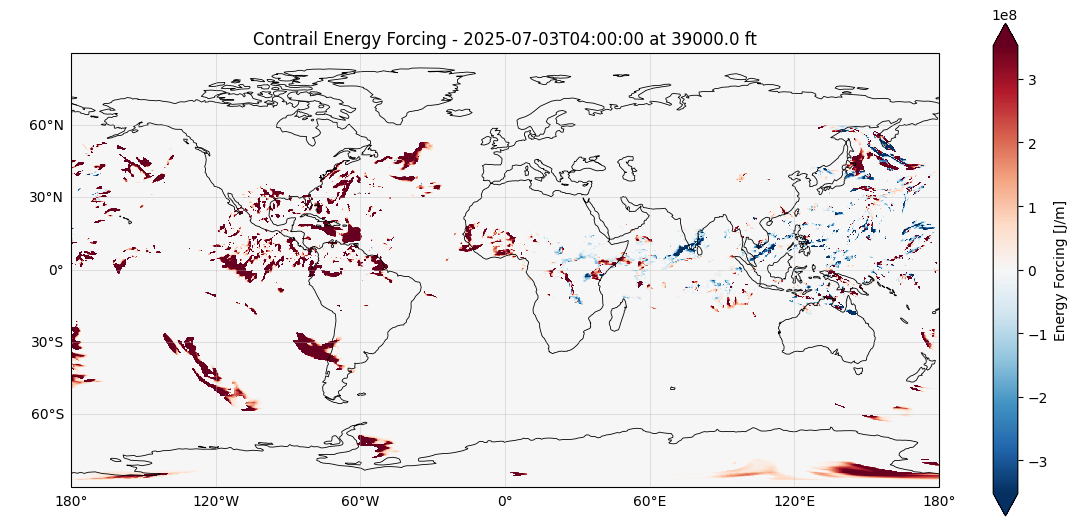
As a reference we also plotted the contrailgrid according to ERA5 model :
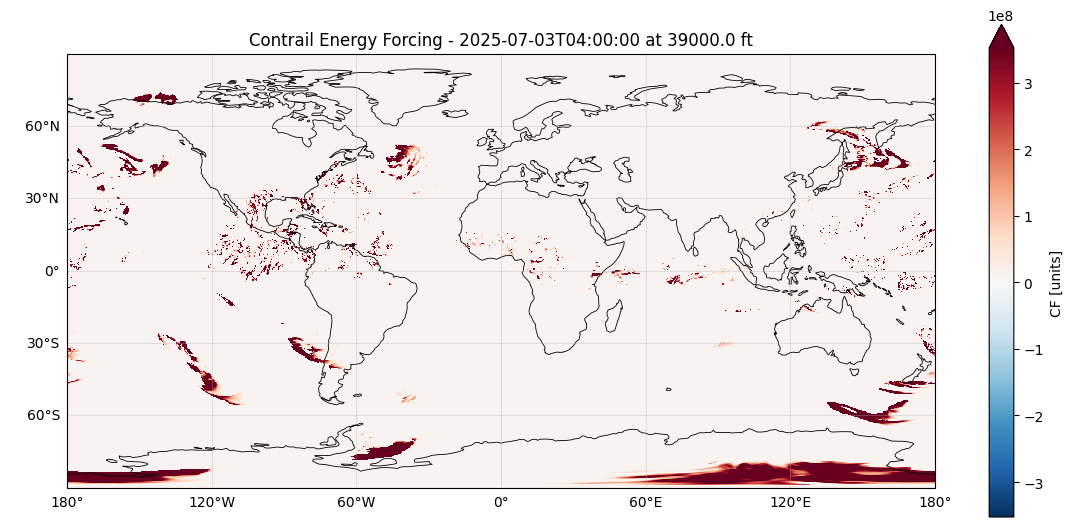
Qualitatively, it can be seen that the shapes of contrail grids are quite similar, with more cooling contrail areas appearing on the DWD forecast.
Integration of DWD weather to Estuaire API
With these improvements in specific humidity and ISSR prediction, Estuaire has integrated the DWD ICON 2-Moment in its climate impact engine. This engine, available through an API, enables the computation of contrail impact for a future or past flight trajectory as well as over a spatio-temporal grid. This enables airlines to analyze the impact of their flights and take mitigation actions.
For more information about how our API works, check out our documentation or if you just want to know more get in touch with our team.
Key Acronyms
- DWD: Deutscher Wetterdienst (German Weather Service)
- ICON: ICOsahedral Nonhydrostatic (weather model)
- ISSR: Ice-Super Saturated Region
- ECMWF: European Centre for Medium-Range Weather Forecasts
- HRES: High-Resolution System
- CoCiP: Contrail Cirrus Prediction (model)
- API: Application Programming Interface
.png)